By Naboth Isaac Niwagaba
The latest Water Atlas for Kabale District has revealed that Community Water sources have increased by 63 % in the last five years, with 1070 new water points recorded in the recent water mapping exercise.
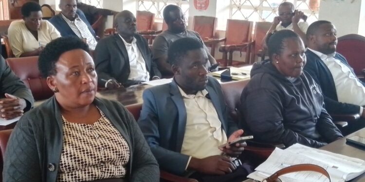
This was revealed during the Meeting to Disseminate the Water Data Collected in November last year, by Non-Governmental Organizations – NGOs, Ugandan Water Project and Wells of Life in partnership with the Ministry of Water and Environment.
In the meeting held yesterday at Kabale District Rukiiko Hall, the Ugandan Water Project Officer in charge of Monitoring and Evaluation Ms. Naigga Vencia explained that they used the Water APP to collect Kabale District’s water data and the intention was to feed the information to the Ministry of Water and Environment as they updated the National Water Atlas.
“We are the largest user of the digital water app, and our findings are shared with the Ministry to help them update the National Water atlas,” she said
She also explained that the Water Atlas for Kabale District was last updated in 2018, and the community water points have since increased from 1,685 to 2,755, as of November 2023 when they carried out the mapping exercise. The water points include protected and non-protected springs, bore holes, gravity water schemes, rain water harvesting tanks, among others.
Ms. Naigga however noted that out of the 2755 community water points, 654 were non-functional, and 17 had been recommended for decommissioning.
In his opening remarks, the Kabale District Principal Assistant Secretary Manzi Gordon who doubled as acting Chief Administrative Officer thanked the NGOs and the Ministry of Water and Environment for updating the water data for Kabale. He noted that they had already identified places that needed priority planning such as Butanda Sub County where there was scarcity of water.
Similarly, the Kabale District Vice Chairperson Miria Akankwasa said that the data collected would be vital in their budgeting process which heavily relied on available data on people’s needs that included safe and clean water.
Eng. Jane Achom, the Deputy Manager at the Ministry of Water and Environment Rural water Regional Centre, Mbarara Office also recognized the financial investments by the Ugandan Water Project and Wells of Life in the Data Collection activities across the country. She asked Kabale District Authorities to properly use the data for strategic planning especially during the budget processes.
Meanwhile, the officials from Ugandan Water Project further revealed that Kabale was one of the 10 Districts that had benefited from the water mapping exercise across the country by February 2024. The other Districts include Lira, Apac, Luwero, Padel, Soroti, Kwania, Sembabule, Lamwo and Nakapiripiriti.
The water mapping helps District Local Governments and the Ministry of Water and Environment to locate water sources, identify places with water scarcity and allocate resources according to the needs of affected communities.
Do you have a story in your community or an opinion to share with us: Email us at editorial@watchdoguganda.com


