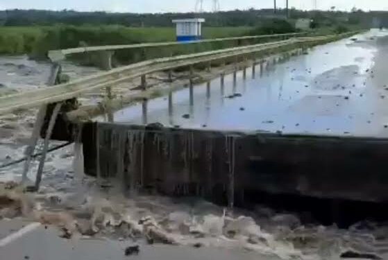
The Ministry of Water and Environment has deployed a team of experts to investigate into the recent flooding at River Katonga Bridge along the Kampala-Masaka Highway.
The experts are also to assess the situation and determine the cause of the flooding.
According to the statement released by the Ministry on Saturday, the flooding caused a major disruption in transportation and affected lives of many individuals in the surrounding communities. The floods also led to the erosion of wetland vegetation, and gardens and caused damage to the Katonga Bridge in the process.
The Ministry also informed the country that currently it’s monitoring the water level and flow of River Katonga at a station located at the Katonga Wetland right at Katonga Bridge.
Similarly, the Uganda National Meteorological Authority also released rainfall figures for the country which indicated that the rainfall in the area has reached 512mm against a long-term average of 200mm for the March to May period.
Preliminary findings indicate that the water level in River Katonga based on the station reading was 4.62m on 10th May which was considered to be changing normally in response to the rainfall received in the catchment.
“The sudden upsurge in the water level by over 2m that eventually caused the flooding at the Kampala- Masaka highway was reported to have started at 3 am on 11th May 2023. This was unexpected based on rainfall and water level measurements, and it is likely to have been triggered by another phenomenon upstream of the Katonga bridge. Katonga Wetland is part of the Katonga Catchment system that spans an estimated area of 13,837 km2. It covers the districts of Mubende, Mityana, Kalungu, Gomba, Sembabule, Kyegegwa, Kamwenge, Kyenjojo, Kiruhura, Lyantonde, Lwengo, Mpigi, Masaka, Kyotera, Bukomansimbi and Butambala. Inspections upstream of the Katonga bridge have revealed a “dam breach” along the 4km stretch of the Kalungu – Gumba road in Bugomola Village, Rwabenge Sub-county in Kalungu District. The local community reported that water had progressively built up on one side of the road due to blocked culverts creating a damming effect…” reads part of the statement.
The ministry also revealed that the rising water level is likely to have created massive force beyond the design capacity of the road creating a dam breach which led to a sudden release of a large volume of water creating a flood wave that moved downstream the Katonga River.
“Typically, as a flood wave moves downstream, it can cause significant damage to infrastructure, such as bridges, roads, and buildings, and can also pose a threat to human life. The speed, height, and extent of the flood wave depend on the volume of water released by the dam, the topography of the surrounding terrain, and other factors such as the presence of vegetation or other obstacles in the river channel…” reads the statement.
Meanwhile, as of 12 May, the water level at all the sections of the Katonga system from upstream to downstream had greatly receded, measuring 5.30m at Katonga Bridge.
According to Ministry, the experts will also conduct a comprehensive study of the river’s hydraulics and hydrology, considering rainfall patterns and water flow rates. The findings of the investigation will be used to develop strategies to prevent similar incidents from occurring in the future.
Do you have a story in your community or an opinion to share with us: Email us at editorial@watchdoguganda.com


